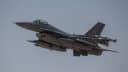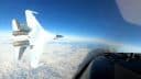
Since the news that a Turkish Air Force RF-4E had been shot down by Syria on Jun. 22, I’ve received several comments and emails from known and reliable sources as well as anonymous people.
Among the hundreds hints, a few suggested that the Phantom downed in mysterious circumstances by a Syrian anti-aircraft artillery off Latakia, was actually a remotely controlled aircraft (a drone), being used to either spying on Assad’s regime activities in northern Syria, or probing Damascus air defenses, as suggested by a NATO pilot and reportedly routinely done in the Aegean with the Greek ones.
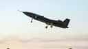
Although the chances that Ankara has modified one its Phantoms to be remotely piloted and used for covert missions inside the Syrian airspace seem to be scarce, I can’t completely rule out the possibility that a sort-of QF-4 (the U.S. aerial target drone F-4) is (or was) flying with the Turkish Air Force.
The TuAF operates the Anka drones, a family of unmanned aerial vehicles (with configuration and size comparable to the MQ-1 and MQ-9) developed by Turkish Aerospace Industries (TAI) for use by Turkey’s Air Force.
According to some sources, with some U.S. help (Americans play a role in almost all conspiracy theories…) TAI could have modified some of its Phantoms to perform unmanned, dangerous spying missions, in which a much faster type of aircraft, offering a higher sensors payload, is needed.
However, it’s just an intriguing theory that was probably fueled by the mysterious flight path of the plane (that included a leg well inside the “enemy airspace”) and, above all, the fact that neither the bodies nor remains of the RF-4E crew members (whose names were released) were recovered since the search and rescue operation was launched in the aftermath of the downing.
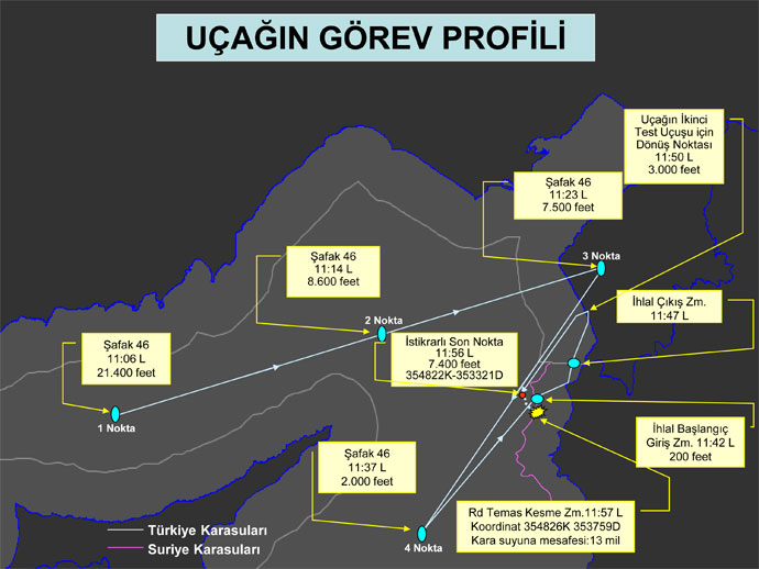
In the meanwhile, the Ankara has released new and even more detailed data about the downed plane [that used radio callsign “Safak 46”] on Jul. 1 in response to the WSJ article that quoted U.S. intelligence sources that backed the Syrian account of the incident.
Here’s a rough translation of the Turkish General Staff statement:
1. The statement is needed to answer the claims based on the story published by foreign press organs about the downing of the aircraft by Syria in international airspace on Jun. 22, 2012.
2. As already stated several times before, the aircraft was shot down in international airspace while flying as a single plane, an unarmed flight mission to test existing radar installations in the region.
3. According with our radar data, and as a result of our investigations: the aircraft took off from Erhac / Malatya at 1030, vectored towards Eastern Mediterranean, approached waypoint #1 at 11:06 local time started to cruise at an altitude of 21,400ft. The aircraft approached waypoint #2 at 11:14 at 8,600ft, waypoint #3 at 11:23 at 7,500ft, waypoint #4 at 11:37 at 2,000ft and return leg for a second test run at 11:50 at 3,000ft. Violation of Syrian airspace lasted about 5 minutes. According to the analysis of radar track and radio comms during the second leg approaching waypoint #4 the aircraft suddenly lost altitude at 7,400 feet altitude at 11:56 and contact was lost at 11:57, in international airspace.
4. Immediately after, a search and rescue mission started and a public statement has been made.
5. Subsequently it was learned that our aircraft was brought down by Syria.
6. As a result, based on the research, analyisis of the radar track history and investigation, the aircraft was hit approximately 13 miles off Syrian airspace, and the last point that the aircraft was flying stable was 35 48.22 North, 33.21 East 35th. From this point the aircraft quickly lost speed and altitude and Syria crashed in Syrian territorial waters 8.5 miles off the coast approximately at 35 48.26 North, 37.59 East.
7. There is no information about the fate of our pilots.
8. The Nautilus ship, used to recover the wreckage of the aircraft is expected to arrive in the area by the evening of Monday Jul. 2.

Make sure to monitor this link to read all the past and future stories on this topic: https://theaviationist.com/category/turkish-rf-4e-shot-down/